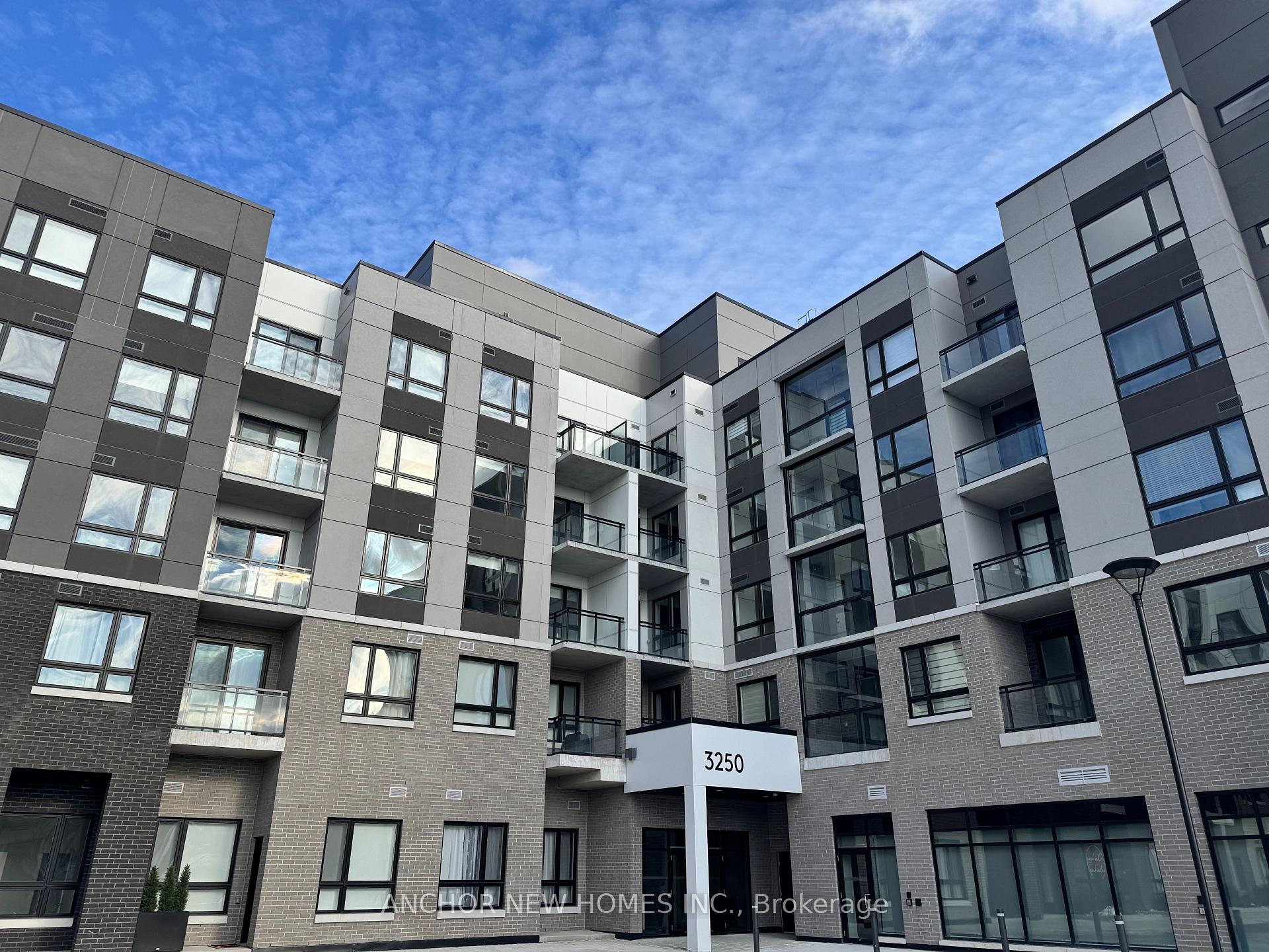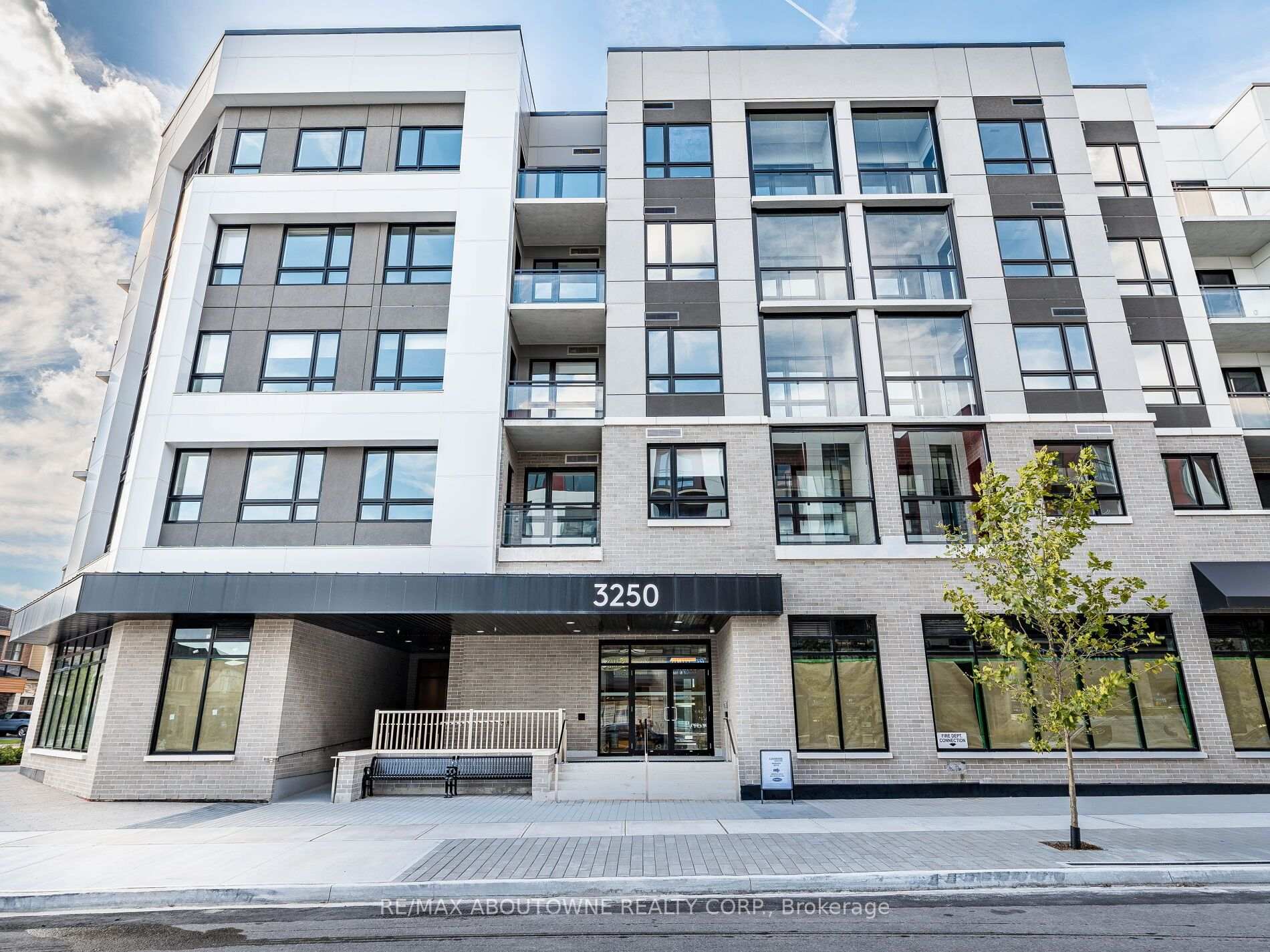
Year Built
2025
by Mattamy Homes Canada
3250 Carding Mill Trail, Oakville, ON
Year Built
2025
Total Units
157
Storeys
5
0
Units for sale
2
Units for rent
From $2,300/mo
Live MLS · Updated daily
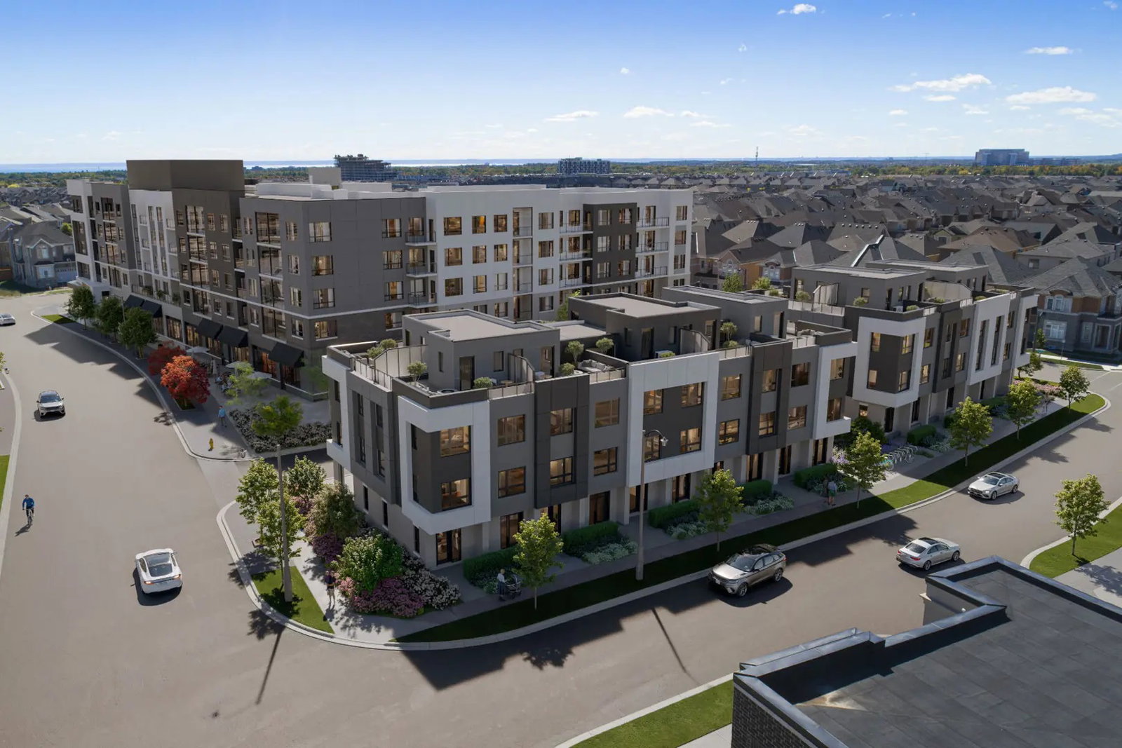
Located at 3250 Carding Mill Trail, Carding House Towns is a 5-storey condo containing 157 units. These Oakville condos for sale were completed in 2025 with units starting at 400 square feet, ranging up to 849 square feet. What makes a Glenorchy condo for sale most appealing is all that the neighbourhood has to offer.
Maintenance fees at 3250 Carding Mill Trail are $0.86 per-square-foot, which is notably higher than the city average of about $0.67.
Developer
Mattamy Homes Canada
Year Built
2025
Property Type
Low-Rise Condo
Storeys
5
Total Units
157
Underground Parking
Fitness Centre
Rooftop Garden
Visitor Parking
Clubhouse
Party Room
Bike Storage
—
Avg $/sqft
Steady
YoY change
—
Avg days on market
Walk Score
—/100
Daily errands on foot
Transit Score
—/100
TTC, GO, subway access
Bike Score
—/100
Bike lanes & infrastructure
Neighbourhood in Oakville
Glenorchy is a peaceful neighbourhood in Oakville, Ontario. It offers a mix of residential homes and condos, making it suitable for families and individuals alike.
7.5
Schools near listings
out of 10 · averaged over 4,442 past and present listings
Fraser Institute ratings within 2 km of each listing, closer schools weighted more
Each score is an average over this area's own listings and is shown only where at least 5 of them carry one. Scores are reported by listing agents, not measured by HOMEH.
Median asking price
$604,000
In Glenorchy
$604,000
In Oakville
$1,419,000
In Ontario
$710,000
Median monthly rent
$2,100/mo
In Glenorchy
$2,100
In Oakville
$3,100
In Ontario
$2,500
≈ 24 years
Of rent to match the purchase price
For sale
6
Median $604,000
Condos 4 · Houses 2
For rent
2
Median $2,100
Recently sold
Sign in to see sold data
Recently leased
Sign in to see leased data
Market data as of 2026-10-23. Sold and leased figures are neighbourhood medians over the last 12 months, published only where at least 5 homes closed — never a single sale.
What people love
Keep in mind
Daily life in Glenorchy is relaxed and community-oriented, ideal for families. Residents enjoy access to parks and schools.
The boundary
9.5 km²
Every count and every census figure on this page was measured inside this line — not within a circle drawn around a centre point.
9
Parks
10
Playgrounds
1
Grocery stores
2
Restaurants
1
Pharmacies
Counted across all 9.5 km² of Glenorchy. From OpenStreetMap, as of 2026-10-19.
7.3/10
Average rating of the 3 rated schools in this area
3
Elementary
Dr. David R. Williams Public School
Public · Grades JK–8 · Halton DSB
476th of 3,045 Ontario elementary schools
1,100 students · EQAO 2024-2025
Oodenawi Public School
Public · Grades JK–8 · Halton DSB
751st of 3,045 Ontario elementary schools
1,080 students · EQAO 2024-2025
St. Gregory the Great Catholic Elementary School
Catholic · Grades JK–8 · Halton CDSB
808th of 3,045 Ontario elementary schools
500 students · EQAO 2024-2025
Ontario Ministry of Education school registry; ratings from the Fraser Institute report card. These are the schools that stand inside Glenorchy, not a catchment — most Ontario boards do not publish attendance boundaries, and we will not draw a line we cannot source. Confirm enrolment with the school board before you buy.
17,886
Population (2021)
34.0 km²
Area
526
People per km²
34.7
Median age
$139,083
Median income
73%
Own their home
3.3
People per household
5,345
Households
Every age
What is built here
Own or rent
73%Owners
27%Renters
Across 5,345 households
When it was built
Mostly 2016–2021
Share of occupied homes, by the era they were built in. Bars are drawn against the busiest era, not against each other, because the eras are not the same length. The eight shares are unlikely to total exactly 100: Statistics Canada rounds each era's count to the nearest 5 before publishing it, so we print what the census reports rather than adjusting a figure to make the column add up.
Statistics Canada, Census of Population 2021. Added up from 15 census areas inside the boundary. Medians and rates are a population-weighted average of dissemination-area figures.
Sources: HOMEH listings, Statistics Canada, Census of Population 2021, OpenStreetMap