Year Built
2000
by United Home Building Corporation
1 Bastedo Avenue, Toronto, ON M4C 3M9
Year Built
2000
Total Units
8
Storeys
3
0
Units for sale
0
Units for rent
Live MLS · Updated daily
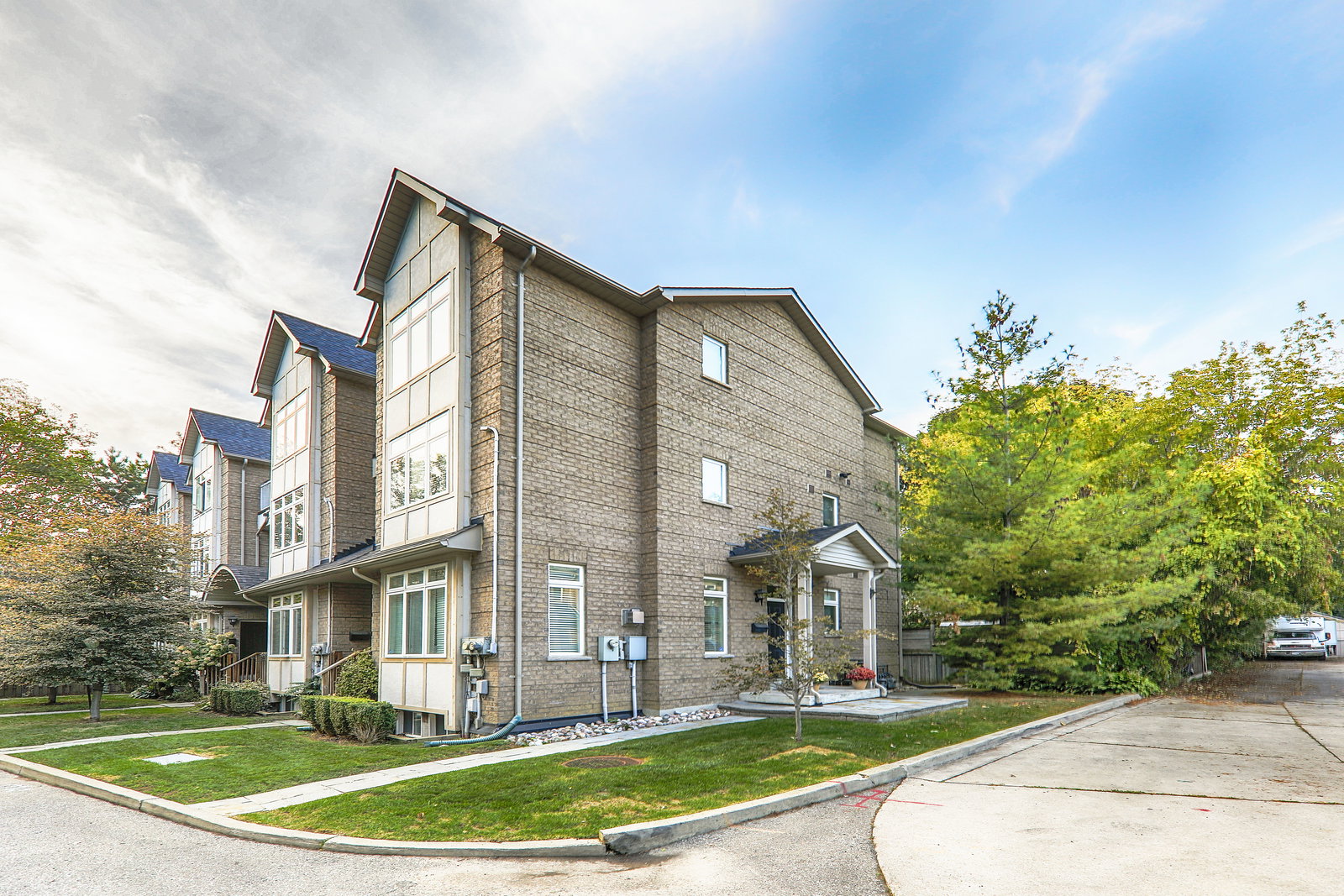
The Williamson Garden Townhomes, developed by the United Home Building Corporation, is an attractive set of residences that particularly caters to the many families attracted to Toronto’s friendly east end. Situated at 1 Bastedo Avenue, they’re nestled beside the lush landscapes the Williamson Ravine, on the south end of a quaint, tree-lined cul-de-sac that branches off of Danforth Avenue.
Completed in 2000, the Williamson Garden Townhomes stands at 3 storeys tall. Now tucked in behind some maturing trees and carefully cultivated gardens, 1 Bastedo was designed to appear timeless and traditional. Clad in richly textured, bright bricks, every townhome has a private entrance of its own, accessed via a cozy front porch no less.
As traditional as they are, these homes feature some unexpectedly striking architecture and boast plenty of magnificent triple-wide window bays and grand dormer windows.
Finally, like many smaller townhome-style condominium developments, 1 Bastedo doesn’t have too much extra room for amenities. Rather, the United Home Building Corporation focused on expertly executing the individual homes themselves.
Developer
United Home Building Corporation
Year Built
2000
Property Type
Low-Rise Condo
Storeys
3
Total Units
8
Management
Self Managed
Underground Parking
Visitor Parking
—
Avg $/sqft
Steady
YoY change
—
Avg days on market
Walk Score
83/100
Daily errands on foot
Transit Score
85/100
TTC, GO, subway access
Bike Score
62/100
Bike lanes & infrastructure
Neighbourhood in Toronto
Woodbine Corridor is a residential neighbourhood in Toronto. It offers a good mix of amenities and accessibility.
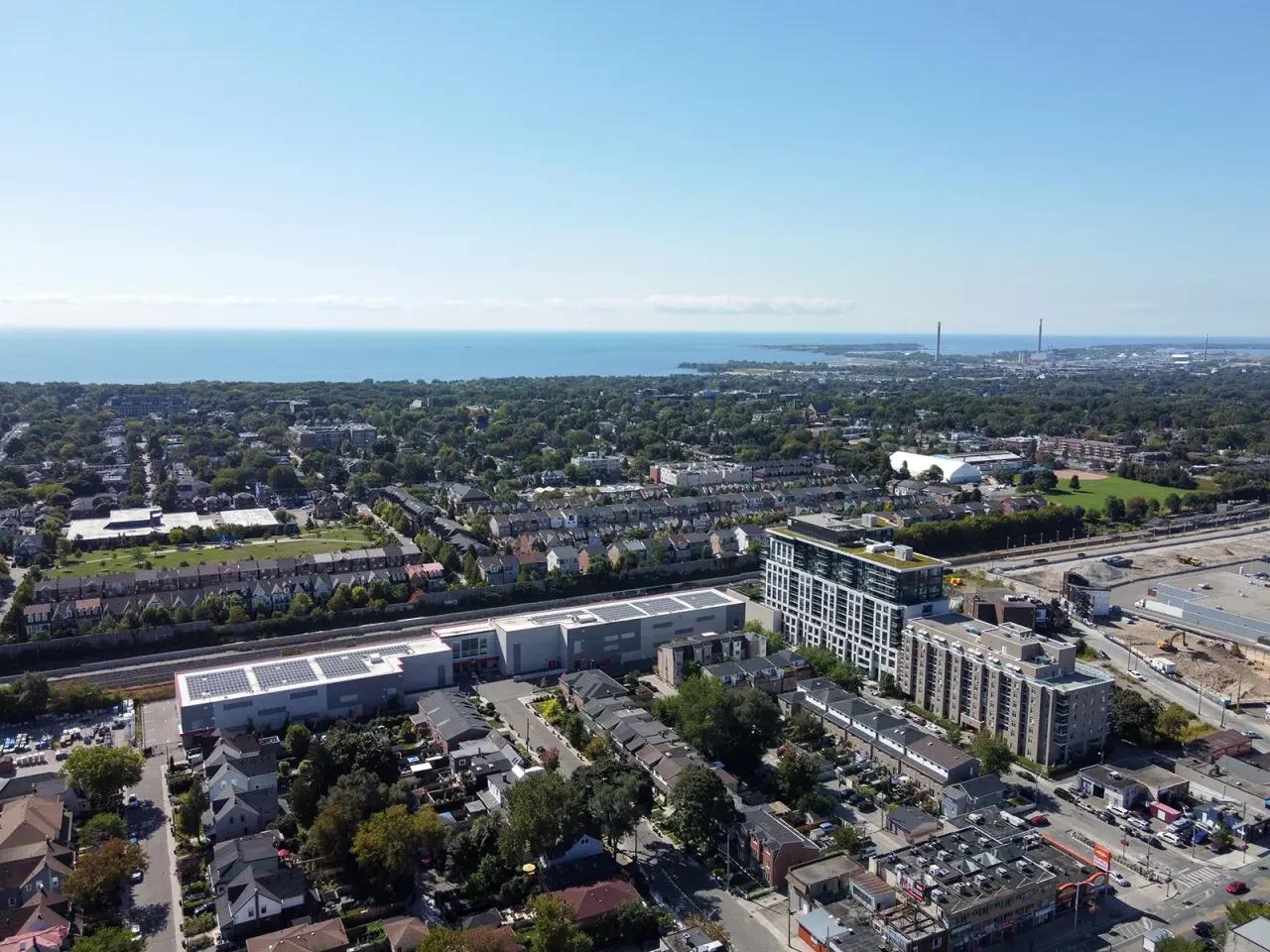
Toronto, Ontario
© Wikimedia Commons contributors (CC BY-SA)
Median asking price
In Ontario
$716,900
Median monthly rent
In Ontario
$2,499
For sale
0
For rent
0
Recently sold
Sign in to see sold data
Recently leased
Sign in to see leased data
Market data as of 2026-08-16. Sold and leased figures are neighbourhood medians over the last 12 months, published only where at least 5 homes closed — never a single sale.
What people love
Keep in mind
Daily life here is convenient with easy access to local amenities. The area feels calm and family-oriented.
The boundary
1.6 km²
Every count and every census figure on this page was measured inside this line — not within a circle drawn around a centre point.
12
Parks
12
Playgrounds
15
Transit stations
1
Grocery stores
5
Restaurants
4
Cafés
3
Gyms
1
Libraries
4
Pharmacies
Counted across all 1.6 km² of Woodbine Corridor. From OpenStreetMap, as of 2026-10-12.
6.7/10
Average rating of the 3 rated schools in this area
3
Elementary
ÉÉC Georges-Étienne-Cartier
Independent · French · Grades JK–6 · CSC MonAvenir
626th of 3,045 Ontario elementary schools
310 students · EQAO 2024-2025
Earl Haig Public School
Public · Grades JK–8 · Toronto DSB
1,026th of 3,045 Ontario elementary schools
660 students · EQAO 2024-2025
Bowmore Road Junior and Senior Public School
Public · Grades JK–8 · Toronto DSB
1,664th of 3,045 Ontario elementary schools
1,030 students · EQAO 2024-2025
Ontario Ministry of Education school registry; ratings from the Fraser Institute report card. These are the schools that stand inside Woodbine Corridor, not a catchment — most Ontario boards do not publish attendance boundaries, and we will not draw a line we cannot source. Confirm enrolment with the school board before you buy.
12,283
Population (2021)
1.6 km²
Area
7,694
People per km²
40.9
Median age
$103,035
Median income
60%
Own their home
2.4
People per household
5,230
Households
Every age
What is built here
Own or rent
60%Owners
40%Renters
Across 5,230 households
When it was built
Mostly 1960 or earlier
Share of occupied homes, by the era they were built in. Bars are drawn against the busiest era, not against each other, because the eras are not the same length. The eight shares are unlikely to total exactly 100: Statistics Canada rounds each era's count to the nearest 5 before publishing it, so we print what the census reports rather than adjusting a figure to make the column add up.
Statistics Canada, Census of Population 2021. Added up from 18 census areas inside the boundary. Medians and rates are a population-weighted average of dissemination-area figures.
Sources: HOMEH listings, Statistics Canada, Census of Population 2021, OpenStreetMap, HOMEH school registry, Photo: © Wikimedia Commons contributors (CC BY-SA)