Year Built
2002
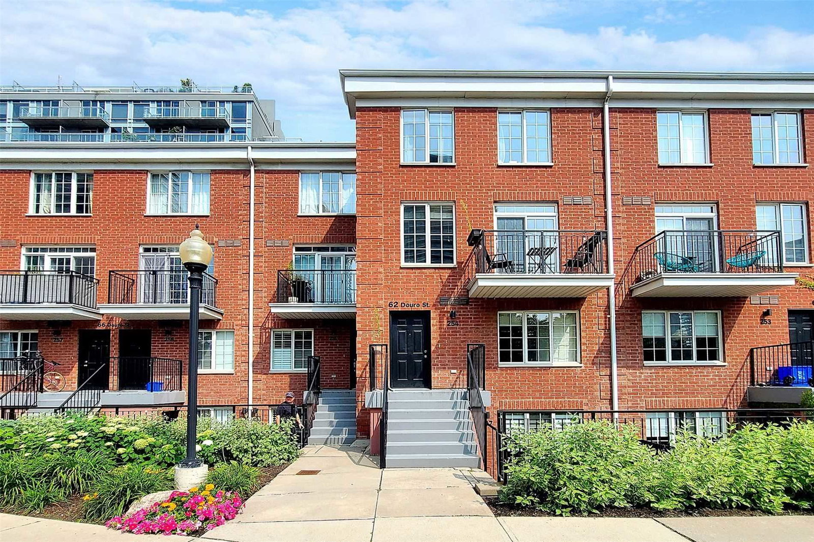
by Urbancorp Development
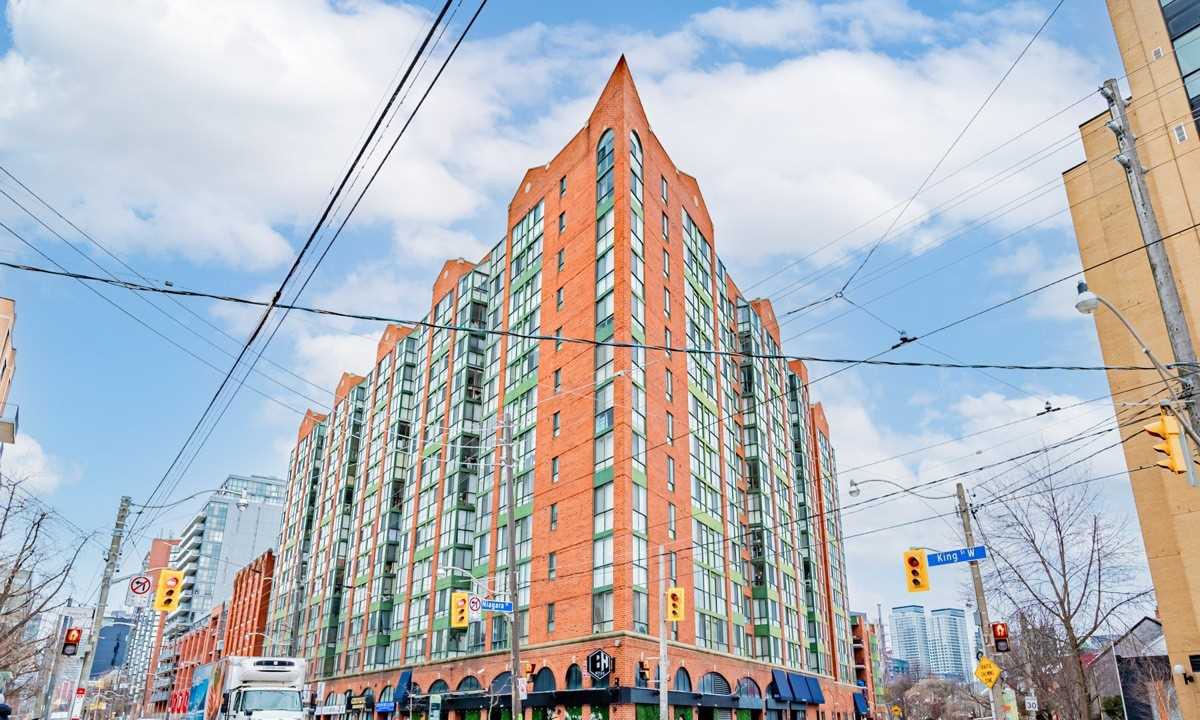
1029 King Street W, Toronto, ON M6K 3M9
Year Built
2002
Total Units
264
Avg $/sqft
$825
Storeys
6
0
Units for sale
0
Units for rent
Live MLS · Updated daily
It’s hard to look at King West neighbourhood today and envision the way it was back in industrial times. But sometimes it’s important to think back, and to learn about this area’s significant history. Above all, an understanding of the neighbourhood’s past is interesting for those seeking King West condos for sale, as well as the homeowners who already call this neighbourhood home.
As the story goes, the Massey Ferguson Agricultural Company was the original proprietor of this land. Eventually, as the Toronto’s industrial production moved out of the city centre, many of the buildings were destroyed to make room for what was next.
And what was next, you might ask? Just take a walk along King West and see for yourself, how the neighbourhood has matured into a hotbed of culture and class.
Along with the businesses that have taken up residence here are buildings such as the Electra Lofts. This soft loft at 70 Douro and 1029 King West was constructed by Urbancorp in 2002, and brought a staggering 257 new homes to the area. The developers even managed to arrange the building so that each unit covers two storeys, while some townhouses are also located onsite.
Besides the homes, the Electra Lofts is home to retail businesses on the ground floor as well. And to top things off, exercise facilities and a party room both inhabit the building too.
Developer
Urbancorp Development
Year Built
2002
Property Type
Low-Rise Condo
Storeys
6
Total Units
264
Management
Horizon Property Management Inc
Rec Room
Games Room
Fitness Centre
Visitor Parking
Theatre Room
Party Room
$825
Avg $/sqft
-11.7%
YoY change
20
Avg days on market
Walk Score
94/100
Daily errands on foot
Transit Score
100/100
TTC, GO, subway access
Bike Score
61/100
Bike lanes & infrastructure
Neighbourhood in Toronto
King West is a vibrant neighbourhood in Toronto known for its lively atmosphere. It offers a mix of urban living with access to various amenities.
7
Schools near listings
out of 10 · averaged over 10 past and present listings
Fraser Institute ratings within 2 km of each listing, closer schools weighted more
Each score is an average over this area's own listings and is shown only where at least 5 of them carry one. Scores are reported by listing agents, not measured by HOMEH.
Median asking price
In Ontario
$716,900
Median monthly rent
In Ontario
$2,499
For sale
0
For rent
0
Recently sold
Sign in to see sold data
Recently leased
Sign in to see leased data
Market data as of 2026-08-16. Sold and leased figures are neighbourhood medians over the last 12 months, published only where at least 5 homes closed — never a single sale.
What people love
Keep in mind
Daily life in King West is dynamic with many options for dining and entertainment. It attracts a diverse crowd looking for an active urban lifestyle.
The boundary
1.2 km²
Every count and every census figure on this page was measured inside this line — not within a circle drawn around a centre point.
11
Parks
7
Playgrounds
35
Transit stations
7
Grocery stores
93
Restaurants
39
Cafés
10
Gyms
8
Pharmacies
Counted across all 1.2 km² of King West. From OpenStreetMap, as of 2026-10-26.
7.4/10
Average rating of the 1 rated school in this area
2
Elementary
1
Secondary
Niagara Street Junior Public School
Public · Grades JK–6 · Toronto DSB
626th of 3,045 Ontario elementary schools
305 students · EQAO 2024-2025
ALPHA Alternative Junior School
Public · Grades JK–6 · Toronto DSB
Not rated
75 students
Oasis Alternative Secondary School
Public · Grades 9–12 · Toronto DSB
Not rated
80 students
Ontario Ministry of Education school registry; ratings from the Fraser Institute report card. These are the schools that stand inside King West, not a catchment — most Ontario boards do not publish attendance boundaries, and we will not draw a line we cannot source. Confirm enrolment with the school board before you buy.
25,090
Population (2021)
1.1 km²
Area
22,396
People per km²
33.2
Median age
$98,675
Median income
46%
Own their home
1.6
People per household
15,860
Households
Every age
What is built here
Own or rent
46%Owners
54%Renters
Across 15,860 households
When it was built
Mostly 2011–2015
Share of occupied homes, by the era they were built in. Bars are drawn against the busiest era, not against each other, because the eras are not the same length. The eight shares are unlikely to total exactly 100: Statistics Canada rounds each era's count to the nearest 5 before publishing it, so we print what the census reports rather than adjusting a figure to make the column add up.
Statistics Canada, Census of Population 2021. Added up from 12 census areas inside the boundary. Medians and rates are a population-weighted average of dissemination-area figures.
Sources: HOMEH listings, Statistics Canada, Census of Population 2021, OpenStreetMap, HOMEH school registry